


Local Forecast
Juneau Area
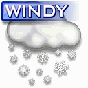
![]() TODAY
TODAY
Today Mostly cloudy. chance of rain. highs in the upper 50s. southeast winds 10 to 15 mph.
![]() TONIGHT
TONIGHT
Tonight Cloudy. chance of rain in the evening, then rain likely late. lows around 50. southeast winds 10 to 20 mph.
Visibility: 10 mile(s)
Cloud Base Height: 0
Record readings this month:
Coldest Day 49.3°F on: Jul 02 2026
Coldest Night 48.6°F on: Jul 03 2026
Warmest Day 52.2°F on: Jul 01 2026
Warmest Night 52.2°F on: Jul 01 2026
Record readings this year:
Coldest Day 11.5°F on: Jan 04 2026
Coldest Night 8.8°F on: Jan 04 2026
Warmest Day 66.2°F on: Jun 23 2026
Warmest Night 66.2°F on: Jun 23 2026
Trends:
Temperature change in the last 24 hours: +2.0 °F
Humidity change in the last 24 hours: + 5 %
Wind change in the last 24 hours:0.0 mph
Rain change in the last 24 hours: 0.020 .in
Barometer change in the last 24 hours: +0.120 .in
New Moon 02:55 UTC June 15 2026
First Quarter 21:56 UTC June 21 2026
Full Moon 23:57 UTC June 29 2026
Last Quarter 19:30 UTC July 7 2026
Phase 81%
Currently 0 consecutive days without rain